Iceland: Land of fire and ice (And trolls. And probably unicorns)…

[Sverige: Del ett | Stockholm, Day 1]         [Sverige: Del två | Bergslagsleden]          [Sverige: Del tre | Birthday in Stockholm]

Iceland is like Sweden’s weird cousin that shows up at all the big holidays. It looks more like the moon or a newly-discovered boiling planet than the other Nordic countries, yet it shares the same ancient gods and speaks some variant of an old mother tongue. It’s intriguing, mysterious, remote, cold and hot (simultaneously)… It’s the one who tells all the cool stories at family gatherings, tales so far-fetched that we’re not sure whether they’re real or not.

It’s roughly the size of Kentucky (or, the size of Ireland and Belgium combined), but with a population smaller than the city of Nice; so once you leave Reykjavik virtually everywhere feels like you’re in the middle of Nowhere. It’s almost like a theme park, divided into regions where the farther from the airport you stray, the more A-tickets you’ll need (Adventure tickets, that is…).

One corner looks like a troll nursery, while another, a boiling cauldron ready to burst its seams and spew scalding water or lava or unicorn entrails… one never knows.

I’ve been curious about this strange place, and I’m known to take a photograph or two (or 642) when I travel, so I made plans for a 3-day stopover here on my way back from Sweden, taking advantage of Icelandair’s #MyStopover promotion, where they don’t charge you extra to add days to your ticket when you fly through Reykjavik. You do, however, get to pay for your hotel, rental car and anything you do or eat while you’re here. One thing to note: Iceland is not cheap. On the plus-side, most of the things to do are outdoors, and for the most part, free (unless you do a tour).

So I land in the land of fire and ice, acquire my rental car (another note: you need 11 different types of insurance to cover the land/air/sea hazards that may or may not occur while driving in this place), and I’m off: first stop the Snæfellsnes peninsula, which I’ve nicknamed Snuffleupagus because it’s only just moderately easier to pronounce, to see mountains and waterfalls and old churches and fantastic coastlines.

My first observation: there are no trees here. But: black mountains and weird green rolling hills pop up from flat expanses, appearing out of the fog like they’ve just sprung from the depths of some grim faery tale. It’s like Kansas meets Mars or the Moon, in black (and green) and gray, but there are still literally no trees, just a smattering of what looks like wheatgrass and moss-covered boulder fields. And rainbows appear on a moment’s notice, since it’s drizzling then sunny…not terribly unlike New England weather. But with ink-black earth. And volcanoes. And maybe trolls.

About an hour outside of Reykjavik, wending my way north and west, I encounter a tunnel*. Only later do I find out that it is called the Hvalfjarðargöng, and only when I’m 1 or 2km in, do I realise it’s the longest tunnel I’ve ever driven (nearly 6km long and 165 metres deep), rock-lined and sloping steeply (8%!) to enable travel beneath the Hvalfjarður fjord. It’s as I resurface here that I behold the first of many Icelandic rainbows I’ll see in the following days.

The hotel is the only thing lit in the little town of Hellnar when I arrive. And by little, I mean there seems only to be the one hotel, a cluster of about 15 clean-cut, brown houses, an old church, a couple of other buildings, maybe another restaurant, and an expanse of coastline. The staff, friendly; the tea, hot; the bed, cosy. I’ve spanned 2500km in a plane and another 230+ kms driving up here in the wild and woolly weather. This flicka is ready for sängen.

I shot on the order of 600 photos in 3 days, beginning that Monday morn. How? When the landscape and the light are otherworldly, and the sky shows a different side every 8 minutes, even a simple snapshot out the window of a hotel room has a mood and a texture like a painting.

So on this new day, when the dreariness looked like it wanted to thwart an entire stopover, I woke up and steeled myself for the worst of elements. At brekkie, though, the clouds broke. For a precious few moments the sun appeared as if it would stay the day… alas, by the time I was ready to embark (a mere 20 minutes later), the skies darkened and Thor reigned (and rained and rained). Undaunted, I set out (rather, there is quite literally NOTHING to do here except look at nature, so I went anyway). First stop: Kirkjufellsfoss.

The road from Hellnar to Kirkjufellsfoss is across the Snæfellsnes peninsula: follow the main road, make a left at the black church “on the corner” and make a right when you see water again. There are few roads here and, it must be stated, they are in very good condition – Iceland even has a website dedicated to road status…the weather here is so changeable that many roads close due to water, mud, snow, ice, etc. at the drop of a hat.

The Kirkjufellsfoss is one of the most-photographed landmarks in Iceland, and my ultimate dream was to capture the Northern Lights here, though I’m doubtful the weather will permit it. I arrive, driving through the small mountains, then along the coast, a drive lined with moss-covered lava fields, dramatic green hills, glacial peaks and an otherwise other-worldly landscape.

The tour bus and teeming tourists turn me off at first (as do the rain and wind). But the clouds momentarily break, the bus leaves, and I am left with a living photograph before me… The shot, worth it. Then the skies then darken and it begins to hail.

Hailstorm, brief, I set off again, towards the seaside town of Stykkishólmur, situated on the northern side of the Snuffleupagus peninsula. It is quaint, and I climb up to the lighthouse during a break in the showers, rewarded with a view of the bay, rainbow touching down on one of the surrounding islands.

My Snæfellsnes loop continued with a stop at the renowned Búðakirkja, a dark-brown church built in the early 1700’s by a Swedish merchant, torn down and rebuilt (twice!) before the mid-1800’s. It is only made more stunning by its site (mountains on one side, the wild North Atlantic on the other) and the magic Icelandic skies. I continue along that coast, stopping multiple times, gape-mouthed, to photograph the landscape. I vow to put that Nikon 14-24 f2.8 lens on my wishlist.

By midafternoon on that first day, cold and wet were factors by which I had stopped measuring my well-being. The weather began as gray, moved to alternately downpouring and sunny, shifted to gale-force winds (in which, at one point, I had to hold onto my rental car to avoid getting flung off a cliff), hail, more rain, then brooding fog. More sacrifices to the gods of Gore-Tex. The winds, unrelenting! Njörðr (Njord), Norse god of sea and wind, is ever-present. One wonders why this strange place wasn’t called Norway instead.

On Tuesday, I’m slated to stay in the South Coast town of Vik. My plan is to head that way in the morning, stopping along the way when I see things that pique my interest. From Hellnar to Vik is about 360km, the weather only marginally better than the day before.

I stopped to get gas in a small town called Hveragerði, somewhere between Reykjavik and Hell(a)… Turns out it’s a geothermal hotbed here, the hillsides boiling just below the surface, and the continental plates threatening to move farther apart at any moment.

I took a small hike in the town’s geothermal park, met a lovely local woman named Jenny (pronounced “Yenny”) and her dog, and visited their quirky earthquake museum, where I stood in the void between the Eurasian and North American plates.

The earth here, mineral-rich and vibrant in the pre-downpour sunshine, seemed to speak…creaking and bubbling as it sent up its wafts of steam from underground cauldrons. The air, its texture, like silk: smooth and thin and soft. Jenny told me she moved here because the energy was different; that the place somehow called her to stay.

As the sun was getting lower in the sky, I stopped to explore Seljalandsfoss, tourist magnet that it is – it’s one of the waterfall wonders here, and because of the stone’s configuration, you can walk behind it (if you don’t mind getting a tad wet!).

And again the landscape changes on this part of the island, on one side of the roadway, there’s glacial peaks bounded by dormant volcanoes, on the other there’s flat, black expanses dotted with what looks like meteorites. It’s remnants from the volcano that erupted here in 2010. Nobody can pronounce Eyjafjallajökull, so they just call it “the volcano that mucked up all the flights.” All this lava yields to fertile fields and farms promising horse riding on the celebrated Icelandic ponies. It changes again as the road wends back towards the coastline, with its basalt cliffs and black beaches. And I arrive at a little guest house in Vik for my final night.

My last morning, I spend an hour or two wandering the hills above the town, then out the jetty to view the Reynisdrangar rocks from my perch some 300 metres into the sea. Legend states that the rocks are mischievous trolls, caught in the sunlight and frozen as pillars of jagged rock, after a night of dragging ships to shore.**

I drive the way I came, stopping along the route to see what I can in the little time left. As I leave, I reflect that what I’ll remember more than the famous waterfalls, the oft-photographed landmarks, and the tourist-filled hotspots, is the landscape leading to-and-from the wonders.

This is how I spent most of my time outdoors in Iceland…this, and holding onto heavy things to avoid getting flung over cliffs.

NB: I’ve found that the coolest, most amazing experiences I’ve had travelling are the ones not in a guide book, but rather what arises (and surprises) when you least expect it: A trail lined with wild blueberries; cartoon mushrooms popping up from the mossy forest floor; fresh kanelbulle from a local baker; a stranger coming to your aid when you are out of options; a kind local guiding you to the best view in a town you can’t pronounce; deep sleep in an old dirt-floored cabin beside a stream; a paddle down a canal beside an urban island once used as the Royal hunting grounds; a hike through rainbow-coloured steaming earth; a hail storm then a magnificent rainbow on a volcanic coastline in a village with 12 houses…

And so, with a last-minute road closure that diverts traffic over a small mountain on a semi-paved road and gets me to the airport almost an hour later than necessary, I leave these Nordic lands behind, hoping to return again as soon as my interpreter will have me.

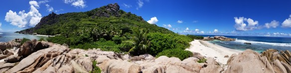
A view from our misty, mossy camp along the Berslagsleden…

[Sverige: Del ett | Stockholm, Day 1]         [Sverige: Del två | Bergslagsleden]          [Sverige: Del tre | Birthday in Stockholm]


*Side note: tired from travel and gobsmacked by the scenery, I accidentally got stuck in the EZPass lane (perhaps ËZPæðþ here?), so time will tell what my penalty is in retrospect.

**According to Norse Mythology, Trolls are said to turn to stone upon contact with sunlight.

Seychelles, Part I: Dinosaurs, Jurassic beaches and going it by bike.

[Seychelles: Part II] [Seychelles: Part III]

After contemplating even farther-flung possibilities (and deciding they’re not possible within our time constraints), somehow we settle on the Seychelles: warm water in which to dive, jungle to explore, the possibility of seeing interesting critters, some fantastically cool topography…flights, booked!

Thank you, Google Maps

Year of Africa continues. There’s always an elephant.

I arrive on the main island of Mahe first, whisked away by an uber-efficient taxi driver, and am greeted in my hotel room by a towel creature in the form of Ganesha, the elephant-god and my patron saint of sorts, bestowing well-wishes on a weary traveller. He’s my reminder that obstacles may be removed to charm a journey but may also be placed in the way as tests of mettle, meddle and might…all of which one might encounter on holiday in as far-flung a place as a speck of an island in the middle of the Indian ocean.

“Actually, the best gift you could have given her was a lifetime of adventures.” – Lewis Carroll

The Seychelles are volcanic islands, and as such, where jungle meets beach is displayed in spectacular form. Look inland, and the lush hills remind you of a scene straight from Jurassic Park – you expect to see T-Rex or one of his contemporaries bounding through the jungle brush at a moment’s notice. The enormous granite rocks that jut out of the sand like monstrous dinosaur teeth invite one into the bathwater-temperature ocean (if you dare…).

After a lazy day fending off jetlag, it’s an early airport run to fetch my flight-weary Calvin, travelling companion (and human) extraordinaire, then a dash to the ferry to take us to La Digue, leaving the relative civilisation of Mahe behind: traffic and construction and bustle, the din of a small city bursting at the seams, desiring to be something larger than it ought. Funny that what we call progress ends up shuttering out the natural world in favour of big buildings, motor vehicles and pavement. Regardless, we’ll be back to spend a day here on the other end of our week’s adventurings.

What we didn’t realise at the time was that this lorry would haul us up the mountain later in the week…

We arrive on La Digue on a Sunday. It’s noticeably quieter than Mahe, the town itself (La Passe) bustling in that charming way you’d expect from an idyllic island where there are few cars and everyone gets around by bicycle. And because we haven’t obtained our bikes yet, we walk the 1.2km to the guest house, up and down the hills that are to become familiar this week, “Left! Left! Left!” on the mind, because even though there are very few cars, there are bikes (and European tourists and Aldabra tortoises) to dodge. English colonisation here has left at least one vestige: left-side driving.

It’s during this walk, about half-way to the guest house, where we encounter our first free-range tortoise.

An aside on the Seychelles and the Aldabra giant tortoise: Seychelles is an archipelago, consisting of 115 islands of all sizes, plunked in the middle of the Indian Ocean, east of Somalia (yes, there are the occasional pirates) and north of Madagascar (and unfortunately no lemurs or other primates). The farthest-flung outer islands are 1100+km from where we are. One island, Aldabra, is a World Heritage Site and the Indian Ocean’s answer to the Galapagos. Its native species include the Aldabra Tortoise, some of which have made their way to La Digue over the centuries. Being easy prey and a good source of food for La Digue’s earliest residents, the La Digue subspecies of the Aldabra giant tortoise is extinct, so the ones that remain on the island are the original Aldabra variety, many of which are kept, quite loosely, as pets.

Needless to say, encountering a 200-kilo walking dinosaur as you drag your luggage uphill on a 30° C day (with equal humidity) is more than enough reason to stop for a fresh fruit juice by the side of the road and interact with local (semi)wildlife.

☀️☀️☀️☀️☀️

We’re here mostly to dive, but our first full day on the island is spent exploring the world-renowned Anse Source d’Argent. This famous beach (Castaway and Crusoe were filmed here) looks even more unreal in person than it does splattering the pages of every travel mag’s world’s best beaches issue. Je suis d’accord.

To get here, a pleasant bike ride takes us to the southern end of the island, through a vanilla plantation that rends the air a sweet and salty mix. The path to the beach goes by the park’s tortoise pen; a weird sight really, with dozens of the massive reptiles lazing in the sun and engaging with chattering tourists who feed them leaves and grass in a United Nation’s collection of languages.

Then, it’s down some jungly paths which end at the promised Anse. It looks like a lost paradise; a sort of déjà vu, because the beach looks both familiar and surreal mere steps from the throngs of tourists sunning themselves (they don’t show you that on the InstaWeb). But we’ve come south of the equator largely to escape the world at large, so trekking farther south to flee the selfie sticks and instaglamourous beachgoers seemed the right option. Also, the tide was coming in. So we earned some of our adventure points* this day by coining a new water sport: aqua-hiking. The water, waist-deep (my waist) by the time we returned from our exploration, was a refreshing yet balmy bath verging on hot at water’s edge – in hindsight, more than a foreshadowing to what a warming planet had to reveal under the surface.

We’re rewarded mere metres from the selfie-crazed masses: we manage to find a completely empty beach and encounter only a handful of humans between Anse Source d’Argent and the southernmost tip of La Digue. The location scouts got this right.

After the aqua-hike back to the throngs, lazing a bit, and an attempt at sunning ourselves to dry out, we decide to air-dry instead: more biking, up and across the island, to Grand Anse.

An overall fantastic day awarded us our first set of adventure points for the trip: 5 for the aforementioned aqua hiking and discovering deserted beaches; 1 for bikes as mode of transport, navigating the wrong side of the road, and dodging the errant tourist and meandering tortoise; and 1 more for feeding (albeit captive) living dinosaurs, aka, giant tortoises.

Tomorrow, we dive.

[Read C’s words on the trip here] [Seychelles: Part II] [Seychelles: Part III]


*A couple of years ago, C and I devised a system of adventure points to reward ourselves for tackling and completing myriad explorations and adventures. The silly ranking system takes into consideration physical effort, wildlife encounters, natural wonders, vistas, summits, mishaps, getting lost (we do this sometimes), finding unexpected treasures, being gobsmacked by the natural world, getting dirty, getting wet, and other general adventuring. [“let’s go exploring…”]